

PHARE SAINT-CLAIR
Sète Civil buildings


Contact
PHARE SAINT-CLAIR
197 Chemin du Phare
34200
SETE
Presentation
An Italian-style lighthouse built in 1903
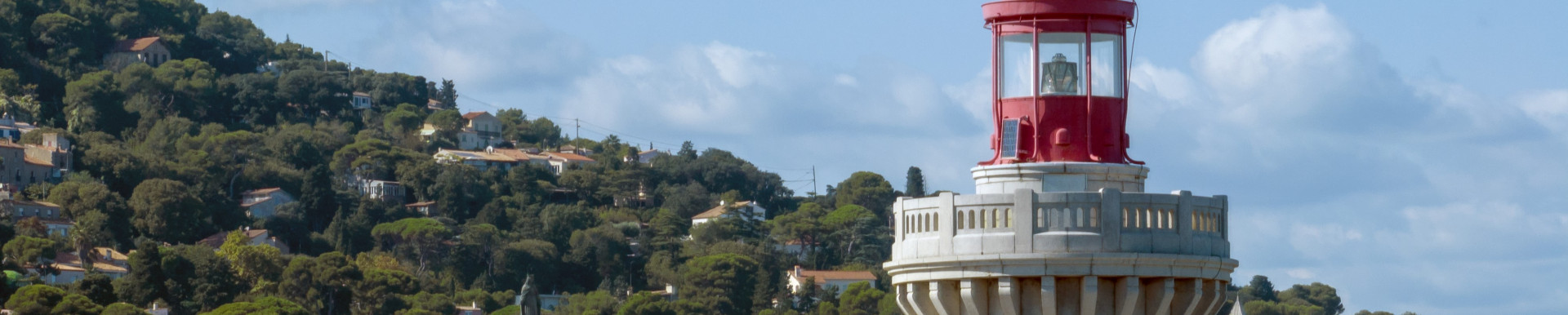
Rising to an impressive height of 92.70 meters above sea level, this Italian-style lighthouse is distinguished by its octagonal stone masonry tower, adorned with corner chains, and its imposing lantern crowned with a copper spherical dome. Guiding ships with precision thanks to its Fresnel lens, this monument offers a remarkable light range of 29 miles, or approximately 53 kilometers.
Paul Valéry’s verses engraved in stone
Engraved on the base of the lighthouse facing the sea are these verses by Paul Valéry: "Its moving eye mingles the flashes of danger with the laughing water and the fickle dance of the waves.” A poetic and unbreakable bond between the lighthouse, the town of Sète, and its most famous son.
A Long History of Maritime Signaling
In 1832, two reflectors installed on Mont Saint-Clair marked the port of Sète, supplementing the original lighthouse on the Môle Saint-Louis. In 1838, two lighthouses were added to the system at the nearby Fort Richelieu. As maritime traffic increased, plans were made to build a large approach lighthouse to guide ships into the harbor and mark the lagoon coastline.
A historic monument listed since 2011
Owned by the State, Ministry of Ecology, Sustainable Development, and Energy, Interregional Directorate for the Mediterranean Sea, the Mont Saint-Clair lighthouse was listed in the Inventory of Historic Monuments by decree dated October 12, 2011.
Rising to an impressive height of 92.70 meters above sea level, this Italian-style lighthouse is distinguished by its octagonal stone masonry tower, adorned with corner chains, and its imposing lantern crowned with a copper spherical dome. Guiding ships with precision thanks to its Fresnel lens, this monument offers a remarkable light range of 29 miles, or approximately 53 kilometers.
Paul Valéry’s verses engraved in stone
Engraved on the base of the lighthouse facing the sea are these verses by Paul Valéry: "Its moving eye mingles the flashes of danger with the laughing water and the fickle dance of the waves.” A poetic and unbreakable bond between the lighthouse, the town of Sète, and its most famous son.
A Long History of Maritime Signaling
In 1832, two reflectors installed on Mont Saint-Clair marked the port of Sète, supplementing the original lighthouse on the Môle Saint-Louis. In 1838, two lighthouses were added to the system at the nearby Fort Richelieu. As maritime traffic increased, plans were made to build a large approach lighthouse to guide ships into the harbor and mark the lagoon coastline.
A historic monument listed since 2011
Owned by the State, Ministry of Ecology, Sustainable Development, and Energy, Interregional Directorate for the Mediterranean Sea, the Mont Saint-Clair lighthouse was listed in the Inventory of Historic Monuments by decree dated October 12, 2011.
Labels, Guides
- Labels et Marques :

Information
- Accessible for people with reduced mobility :
- Pets :
- No

Opening day(s)
From Saturday 19 to Sunday 20 September 2026
Destination
PHARE SAINT-CLAIR
197 Chemin du Phare
34200
SETE
GPS coordinates
Latitude : 43.3957116
Longitude : 3.68983610