L'ÉTANG DE VIC
VIC-LA-GARDIOLE


Presentation
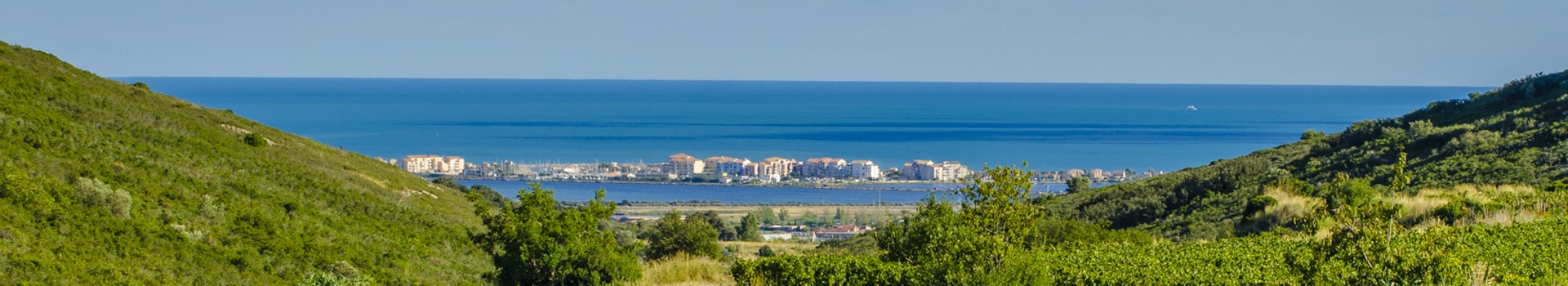
At the heart of the Etangs Palavasiens Natura 2000 site, the Etang de Vic offers a rich natural spectacle, shaped by water, wind and light. Situated between the Massif de la Gardiole to the north and the Lido des Aresquiers to the south, this lagoon of over 1,000 hectares, linked to the sea by the Canal du Rhône à Sète, is one of the wetlands of international importance classified by the Ramsar Convention.
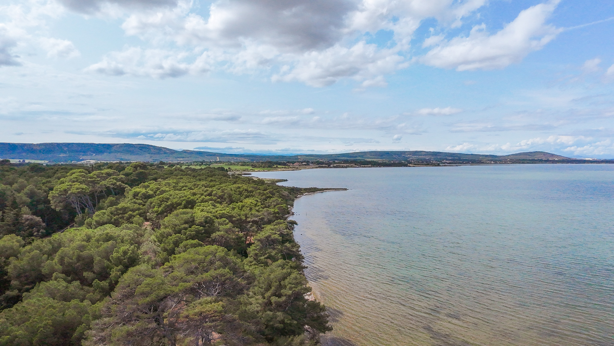
Here, nature can be observed from a wide angle: dunes, sansouïres, wild beaches, former salt marshes, straight channels? The atmosphere is unique, with an almost flat landscape where the gaze loses itself, punctuated by the reflections of water and the flight of birds.
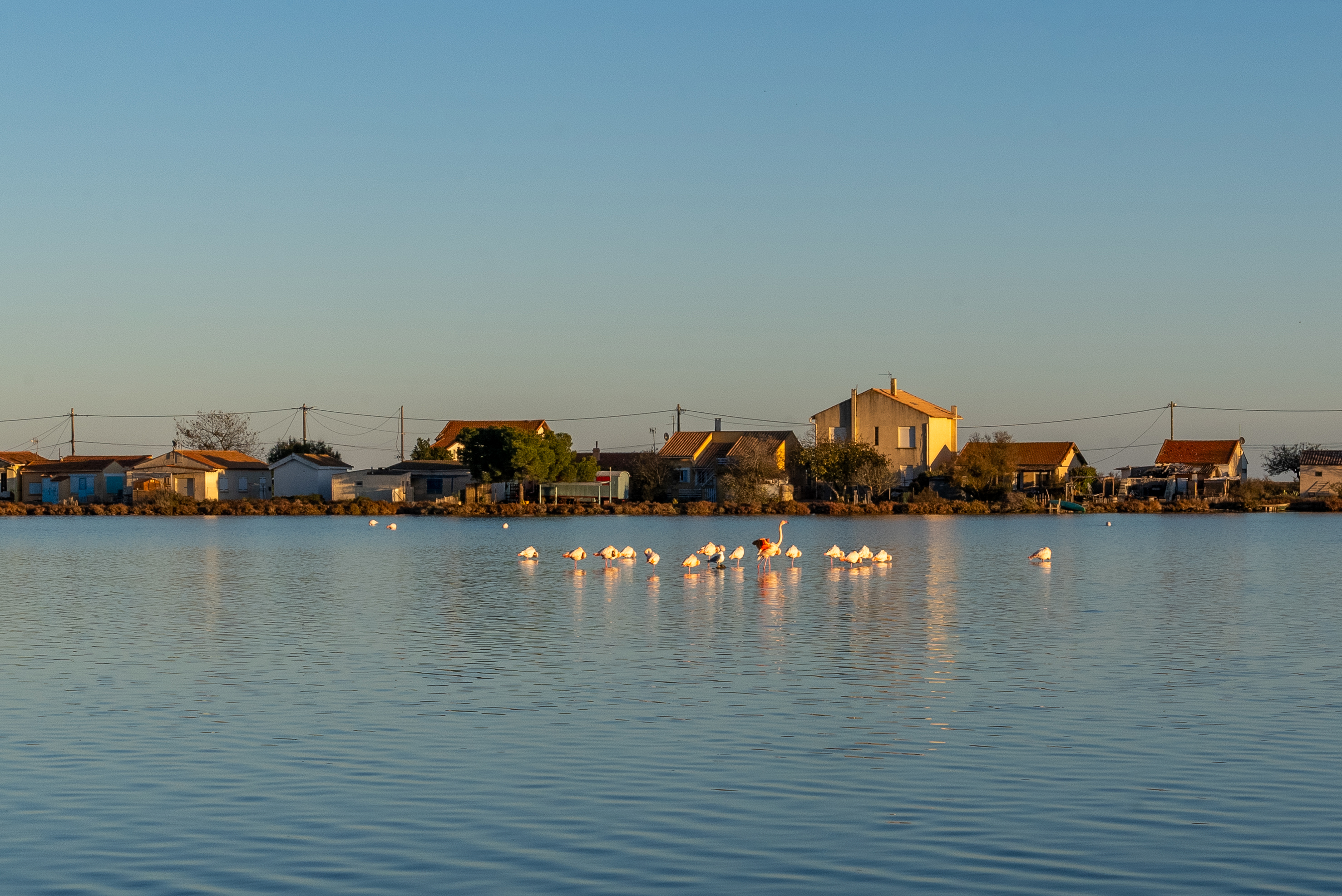
Etang de Vic is a biodiversity hotspot, home to a multitude of species. From migrating flamingos, ducks and waders in winter to nesting terns (little, caugek and common) in spring, the avifauna is omnipresent. It's also one of the few places where gulls and rarer birds such as red knots and Caspian terns can be found.
The aquatic environments are home to a wide variety of fish species, from sedentary (gobies, sunfish, blennies) to migratory (bream, mullet, eels, etc.). On the lido beaches, the flora is not to be outdone, with remarkable species such as sea lily, dune thistle and euphorbia peplis.
In terms of heritage, the Canal du Rhône à Sète, dug in the 17th century and still in operation, crosses the pond from east to west. It is also an area of traditional fishing, with capétchades, and gabion hunting, still practiced today.
The entire site is protected by the Conservatoire du Littoral, which has an active preservation policy covering 1,800 hectares.
Access and discovery :
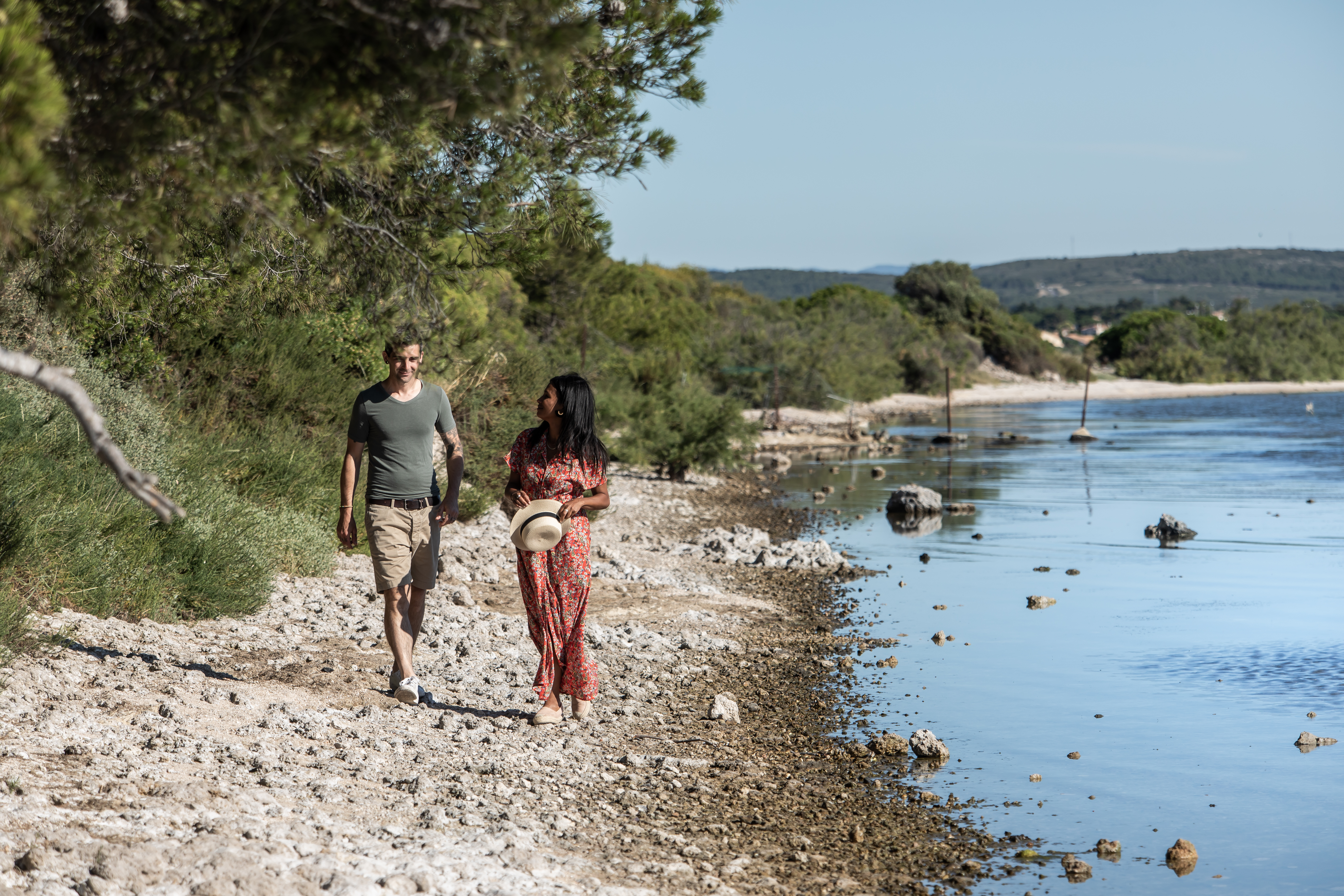
To explore the Etang de Vic, head for the Pont des Aresquiers. From here, there are two options: follow the lido to discover the dune belt and its wild landscapes, or walk along the Canal du Rhône à Sète towards Palavas to observe the pond and its inhabitants. Another viewpoint is the Gardiole massif, whose heights offer a spectacular panorama of the entire site.
During your visit, remember to preserve the beauty of this exceptional site by respecting the flora and fauna, as well as the tranquillity of the area and other visitors who also come to enjoy this unspoilt natural setting.
Here, nature can be observed from a wide angle: dunes, sansouïres, wild beaches, former salt marshes, straight channels? The atmosphere is unique, with an almost flat landscape where the gaze loses itself, punctuated by the reflections of water and the flight of birds.
Etang de Vic is a biodiversity hotspot, home to a multitude of species. From migrating flamingos, ducks and waders in winter to nesting terns (little, caugek and common) in spring, the avifauna is omnipresent. It's also one of the few places where gulls and rarer birds such as red knots and Caspian terns can be found.
The aquatic environments are home to a wide variety of fish species, from sedentary (gobies, sunfish, blennies) to migratory (bream, mullet, eels, etc.). On the lido beaches, the flora is not to be outdone, with remarkable species such as sea lily, dune thistle and euphorbia peplis.
In terms of heritage, the Canal du Rhône à Sète, dug in the 17th century and still in operation, crosses the pond from east to west. It is also an area of traditional fishing, with capétchades, and gabion hunting, still practiced today.
The entire site is protected by the Conservatoire du Littoral, which has an active preservation policy covering 1,800 hectares.
Access and discovery :
To explore the Etang de Vic, head for the Pont des Aresquiers. From here, there are two options: follow the lido to discover the dune belt and its wild landscapes, or walk along the Canal du Rhône à Sète towards Palavas to observe the pond and its inhabitants. Another viewpoint is the Gardiole massif, whose heights offer a spectacular panorama of the entire site.
During your visit, remember to preserve the beauty of this exceptional site by respecting the flora and fauna, as well as the tranquillity of the area and other visitors who also come to enjoy this unspoilt natural setting.
- Equipment :
- Ponds
Destination
L'ÉTANG DE VIC
Chemin de la Source
34110
VIC-LA-GARDIOLE
GPS coordinates
Latitude : 43.49803
Longitude : 3.78696