ITINÉRAIRE ACCESSIBLE - SENTIER JOËLLETTE DE SAINT-FARRIOL

")
")
")
")
")
")
Contact
ITINÉRAIRE ACCESSIBLE - SENTIER JOËLLETTE DE SAINT-FARRIOL
Presentation
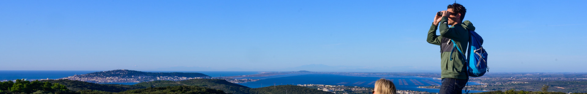
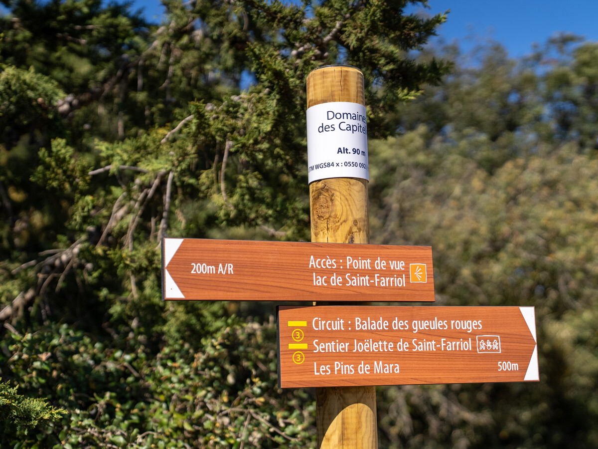
To the north of the Etang de Thau lie the hills of La Moure. In the commune of Villeveyrac, you'll discover the Saint-Farriol lake, the garrigue and its capitelles.
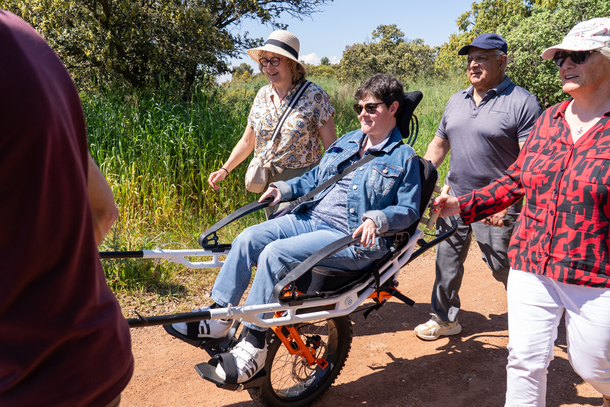
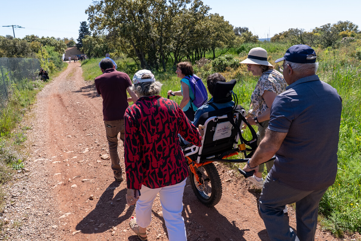
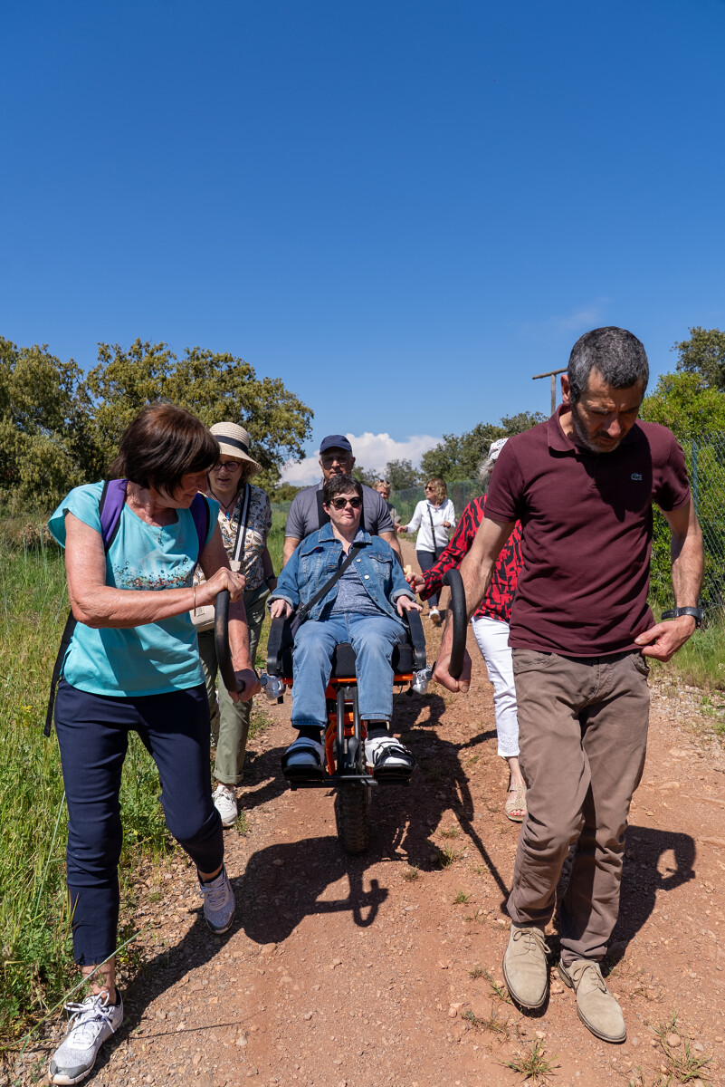
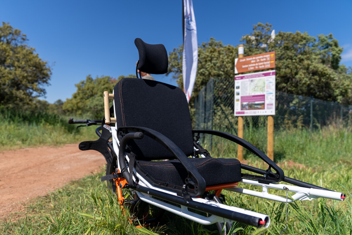
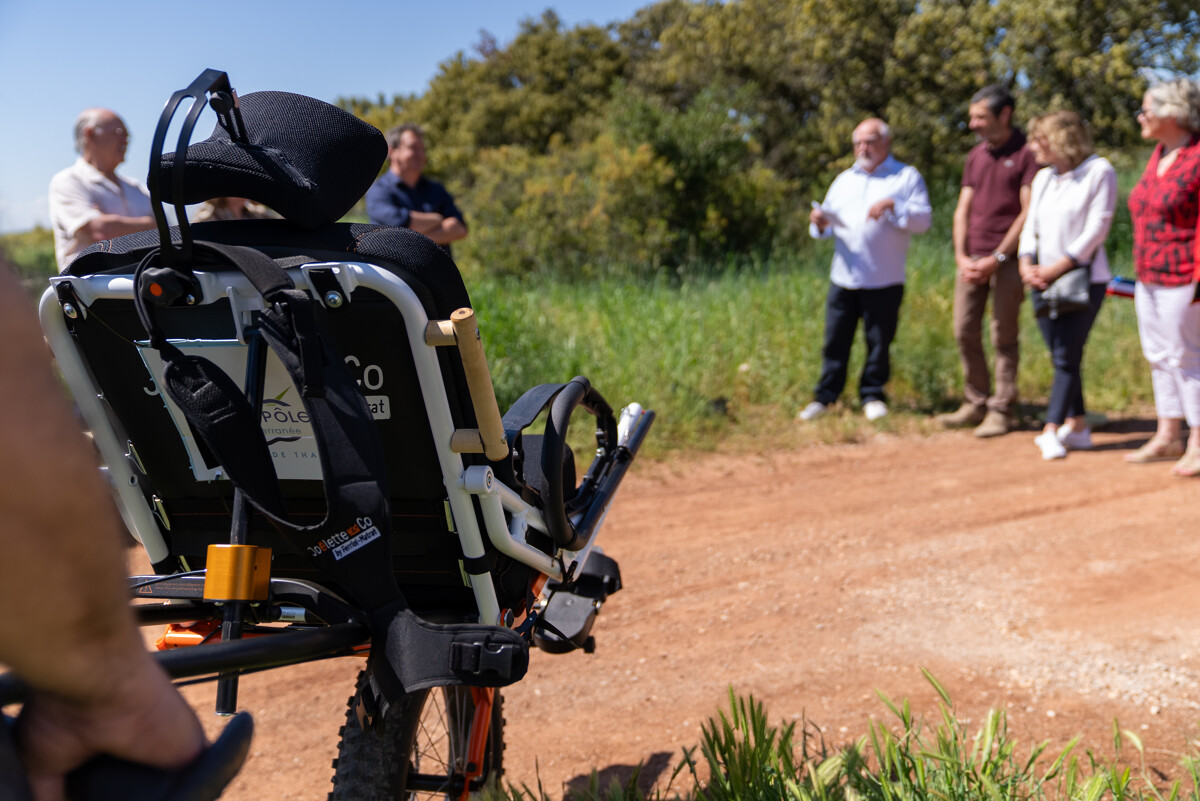
The joëlette trail from Saint-Farriol to Villeveyrac is the first official circuit in the Hérault region. The joëlette is an all-terrain wheelchair with one wheel, enabling it to negotiate trails. This wheelchair enables people with motor disabilities and reduced mobility to enjoy hiking.
The joëlette trail from Saint-Farriol to Villeveyrac is the first official circuit in the Hérault region. The joëlette is an all-terrain wheelchair with one wheel, enabling it to negotiate trails. This wheelchair enables people with motor disabilities and reduced mobility to enjoy hiking.
- Type d'itinéraire :
- Cheminement Handicap
- Thématique :
- Naturel
- Level :
- Beginner
- Distance :
- Distance 2,9
- Durée en heures :
- 01:30
- Dénivelé positif :
- Dénivelé 50
- Dénivelé négatif :
- Dénivelé négatif 50
- Itinéraire boucle :
- oui
- Balisage :
- Jaune PR
FICHE_INFO_TITRE_ACCESSIBILITE
||||||1||#||||||2||#||||||3||#||||||4||#||||||5||
Destination
ITINÉRAIRE ACCESSIBLE - SENTIER JOËLLETTE DE SAINT-FARRIOL
GPS coordinates
Latitude : 43.4799030
Longitude : 3.61344122